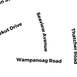
93 WAMPANOAG RD
Owner Information
BELENKY ALEKSANDR
18 CHAMPA ST
NEWTON, MA 02464


Property Details
93 WAMPANOAG RD is classified as a Single Family Residential (Colonial).
The primary structure on this property was built in 1970. There are 2,664ft2 of built area within this property. There is 2,280ft2 of residential/living space within this property.
93 WAMPANOAG RD is valued at $408,200. The land is valued at $153,200 and the structures are valued at $252,600. There is an additional valuation of $2,400 on this property.
The most recent deed for 93 WAMPANOAG RD is recorded at the local registrar in Book D1343004, Page 0. 93 WAMPANOAG RD was last sold on Thursday, March 29, 2018 for $342,562.
Assessment data from fiscal year 2022.
Flood Data
This property is completely within the AE Zone (within floodplain).
The base flood elevation for this flood zone is 11 feet.
This information is sourced from the FEMA National Flood Hazard Layer. See our full disclamer.
Broadband Internet Providers
| Provider | Type | Bandwidth (mbps) | |
|---|---|---|---|
| VSAT Systems, LLC. | Satellite | 2 | 1 |
| Comcast | Cable | 1000 | 35 |
| Verizon New England Inc. | DSL | 1 | 0 |
| Viasat Inc | Satellite | 35 | 3 |
| GCI Communication Corp. | Satellite | 0 | 0 |
| HughesNet | Satellite | 25 | 3 |
Broadband service provider data from December 2020.
Adjacent Properties
- 84 OCEAN AVE
Two-Family Residential owned by MATTACHEE HOLDINGS LLC - 71 NANTUCKET AVE
Single Family Residential owned by ALBANESE ELLEN JANE - 88 OCEAN AVE
Single Family Residential owned by BUSCHMANN DALE M - 4 KATAMA WAY
Single Family Residential owned by WOLASZEK DOROTHY A (LIFE EST) - 8 KATAMA WAY
Single Family Residential owned by RUEGG MARK A